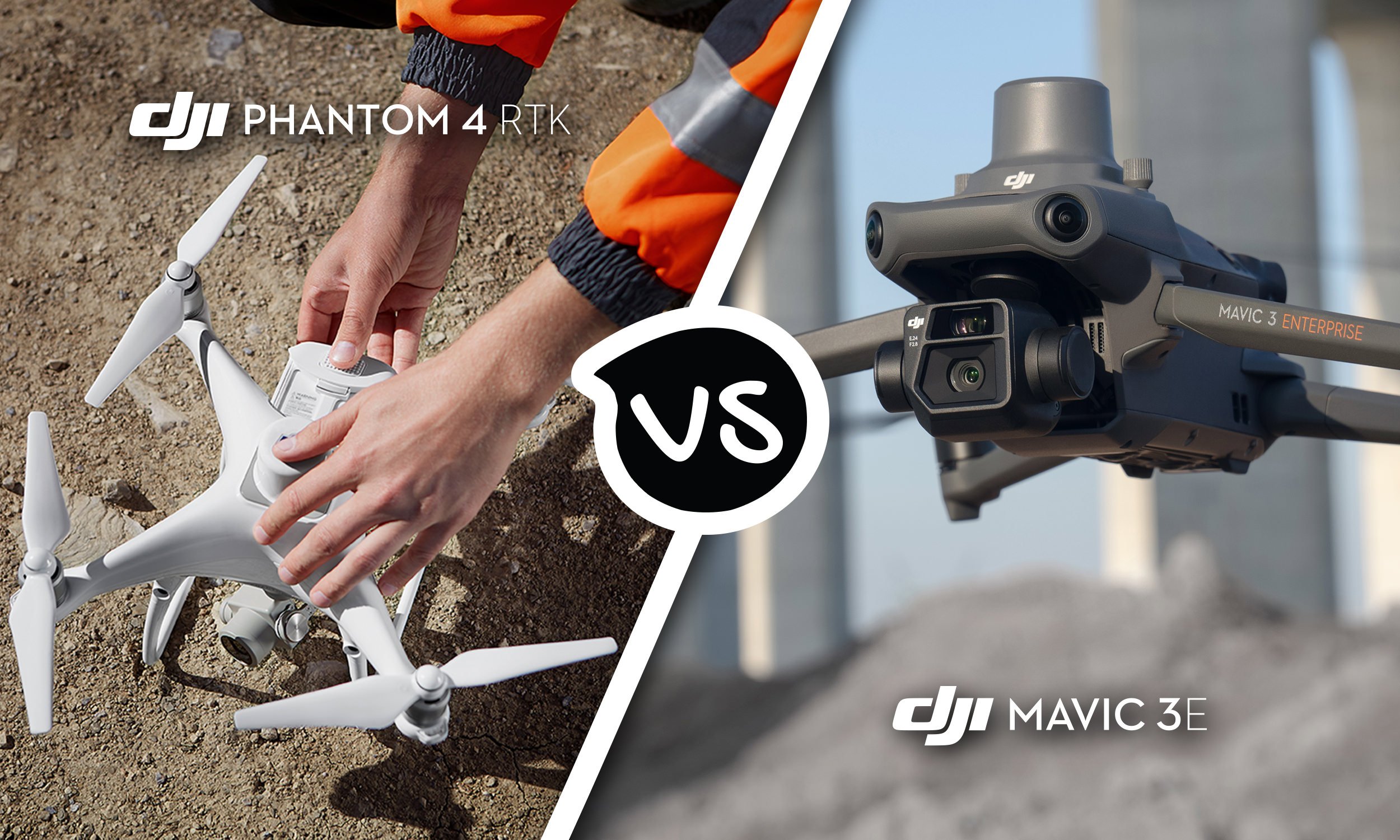
DJI Phantom 4 RTK vs DJI Mavic 3 Enterprise
When it comes to surveying, mapping, and photogrammetry, DJI has paved the way with its outstanding range of cutting edge drones. And with the release of the Mavic 3 Enterprise Series, they have set a new standard of excellence. While the DJI Phantom 4 RTK was a worthy predecessor, this new lightweight aerial surveying solution delivers higher levels of precision and accuracy – giving you greater control and project efficiency (2 hour projects have been reduced to just 15 minutes*). Read on to learn the key differences between these drones, and find out why you should upgrade to the DJI Mavic 3 Enterprise today.
Read More
Trade in your Phantom 4 and get up to $1,350 off a Mavic 3 Enterprise
Until the 15th of May, trade in your Phantom 4 and receive up to $2,300 off a brand new Mavic 3 Enterprise RRP $6,999.
Read More
POI Mode, Improved Terrain Follow: New Features Coming to Your DJI Drones
The next major firmware update for your DJI Enterprise drone is here! DJI have consolidated months of user feedback and testing into an update that packs in loads of new features for the Mavic 3 Enterprise series, Matrice 30 series, and Matrice 300 RTK professional drone platforms. Safe to say, your everyday commercial drone is now more powerful, capable, and helpful than ever.
Read More
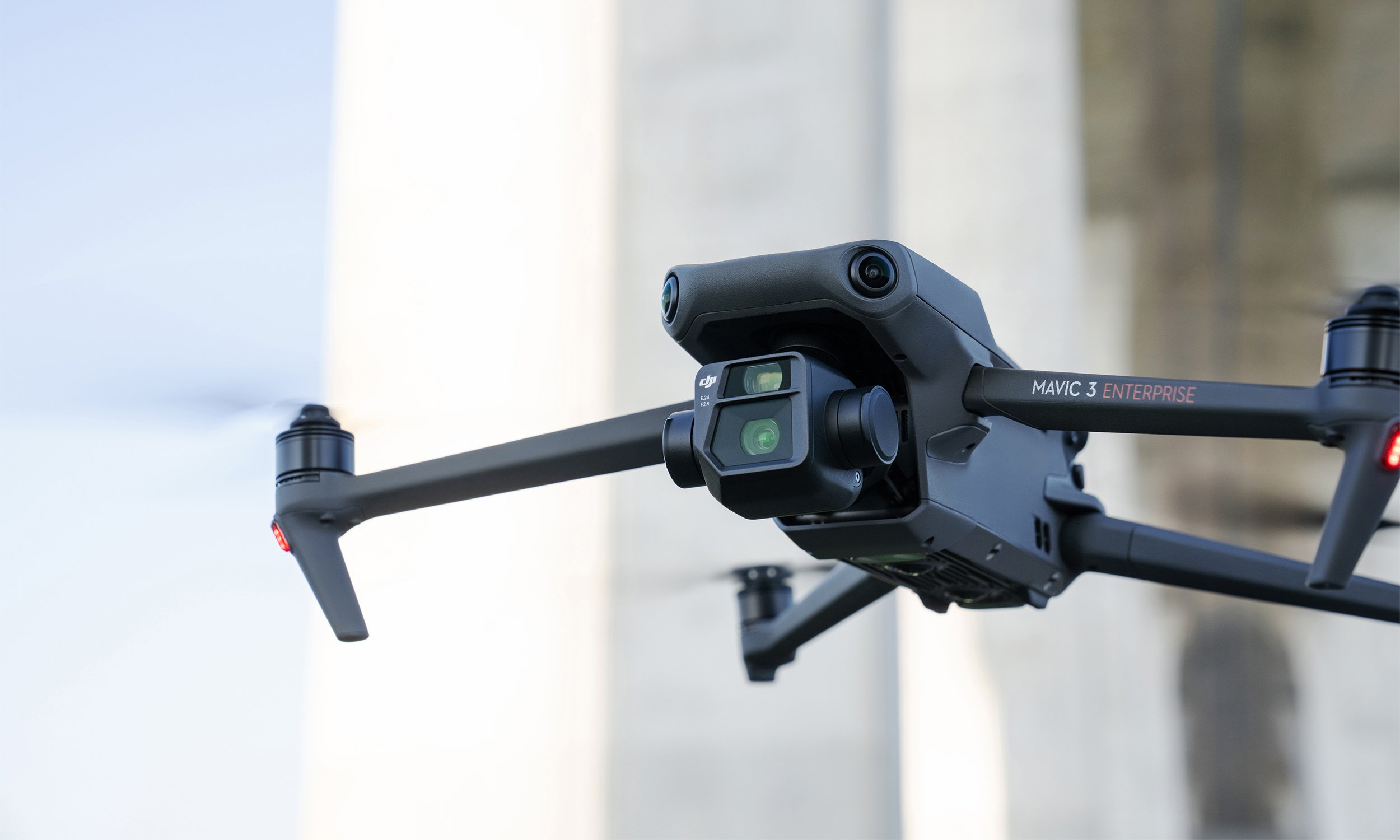
Top 7 Features of the Mavic 3 Enterprise Series
The Mavic 3E (M3E) is a compact, portable, and powerful drone for everyday operations. Whether you’re a hobbyist pilot ready to go pro or searching for a versatile platform to bolster your commercial fleet, the Mavic 3E sets a new industry benchmark.
The M3E’s features make it our most accessible and capable surveying drone to date, while a thermal version, Mavic 3T, is available for emergency, inspection, and night operations. Here are seven things that make the Mavic 3 Enterprise Series the ultimate portable and professional drone platform.
Read More
The New DJI Mavic 3 Enterprise Series Sets Ultimate Standard For Portable Commercial Drones
With A 56× Zoom Camera And RTK Module For Centimeter-Level Precision, The Mavic 3 Enterprise Series Brings Mission Efficiency To New Heights.
Read More
Comparing DJI's Thermal and Low Light Drones
Trying to choose a drone platform for low light or thermal ops? See how the Matrice 30T (M30T), Zenmuse H20N camera, and Mavic 2 Enterprise Advanced (M2EA) results look side by side
Read More
Let EcoFlow Power Stations Keep You In The Air For Longer
EcoFlow power stations are the perfect solution for battery maintenance and getting more flight time out of your drone when on the road or away from a power source.
Read More
Why You Need A Pilot On Your Team
As more surveyors see the benefits of integrating drones into their projects, companies are now looking to train their team to take the controls themselves. Upskilling has never been easier with a breadth of new courses specifically designed to turn surveyors into competent and confident drone pilots.
Read More
Top 6 Features of the H20N
The DJI M300 has set the standard for enterprise drones with a combination of durability, performance, and advanced payloads. It was released in 2020 alongside the Zenmuse H20, a hybrid multi-sensor solution for industrial applications and public safety missions. The H20T, L1, and P1 followed soon after. Our latest payload, the H20N, is a hybrid thermal, zoom, laser rangefinder, and Starlight sensor that offers powerful aerial insights - no matter the weather or time of day.
Read More
Top 5 Features of the DJI Dock
Drone technology has impacted every industry that involves gathering data at scale. The next step is for these revolutionary tools to operate with greater autonomy in remote locations and without supervision. The launch of the DJI Dock makes this a reality. It’s a durable, easy to set up, fully-programmable base station for the Dock Version of the Matrice 30 Series. In other words: it’s everything you need to have automatic, repeatable drone workflows for asset inspection, and more.
Read More
Top 9 Features of the M30
For years DJI have been working closely with public safety teams and infrastructure inspection crews to take enterprise drone technology forward and integrate it into critical operations. The new DJI Matrice 30 is a case in point, with features inspired by the lessons DJI have learned from thousands of flight hours and feedback from pilots on the front lines.
The launch of the M30 once again pushes the boundaries of what’s possible. They have incorporated flagship features and performance into a foldable airframe you can fit inside a backpack.
From rapid deployment to compatibility with the new DJI Dock, here are nine things that make the M30 a groundbreaking drone for public safety and asset inspections.
Read More
Using Point Clouds
Whenever you need to create a detailed model of an area — for surveying, accident reconstruction, or any other purpose — creating a point cloud can be the best way to get the job done.
An accurate, detailed, high-resolution 3D point cloud model is an important element in accurate 3D model creation. If your organization is seeking a new way to create digital reconstructions of physical spaces or structures, drones capable of generating point clouds may be the perfect tool for you.
Read More
Why RTK Hardware is Here to Stay
How accurate is accurate enough? If you’re like most land surveyors, the answer is “as much as possible.”
With an RTK drone, surveyors and other kinds of enterprise drone pilots can expect centimeter-level positioning accuracy with each flight. The system represents a marked improvement from satellite data on its own and can help ensure you have the accurate information you need to get the job done.
Read More
Thermal Drone Applications
Thermal imaging in drones has been gaining popularity in recent years as this technology has become more accessible with significant price decreases in recent months.
In this article we are showcasing a selection of applications our customers in New Zealand have been using with thermal drones.
Read More
Matrice 300 Asset Inspection
Take a look at some sample footage from the Matrice 300 RTK and Zenmuse H20.
Read More
Thermal Camera on Drones how do they work?
Remote aerial sensing technology gives inspection personnel, Search and Rescue and Law Enforcement agencies more thorough, frequent, safer, and efficient inspections. Drones equipped with infrared cameras can be used to detect irregularities in insulation and pooling water, find a missing person in dangerous terrain or assess a fire hazard situation. With a zoom camera drone, the pilots can visually identify problems without having to be physically there. Read more to find out about Thermal Imaging Drones.
Read More
Ferntech Brings DJI's Most Advanced Commercial Drone to New Zealand
We at Ferntech Commercial is excited to bring this technology to our shores in New Zealand. The DJI Matrice 300 RTK is an exceptional drone offering up to 55 minutes of flight time, advanced AI capabilities, 6 Directional Sensing & Positioning and more; the DJI Matrice 300 RTK sets a whole new standard by combining intelligence with high-performance and unrivalled reliability.
Read More
RTK and PPK survey drones, what is the difference?
Over the last 12 months, we have seen a large increase in New Zealand geospatial professionals utilising drones to capture centimetre accurate survey-grade photos and data. With the development of RTK enabled drones the surveying process has become faster, safer and more efficient.
Read More
Drone Integration at Woods Consultancy
We interviewed Maksym Khovalko, UAV Specialist at Woods to learn more about how they utilise drone technology on their projects. Woods is a New Zealand, and employee-owned multi-disciplinary consultancy with a primary office located in Auckland and a secondary office located in Christchurch. Established in 1970, Woods has now grown to become a substantial consultancy with a team of 120 specialists providing Urban Design, Architecture, Engineering, Planning, Surveying and Geo-Spatial services to the land development, building, health, institutional, energy, government, and transport sectors, to name a few.
Read More
DJI launches a gas detector and spotlight for the Matrice series
With it’s annual Airworks event in Los Angeles on the horizon, DJI have announced two new Enterprise payloads designed for the Matrice series. Powered by DJI Skyport, the U10 AUV Based Laser Methane Leakage Detector and the Wingsland Z15 Gimbal Spotlight have been designed with specific commercial applications in mind.
Read More